














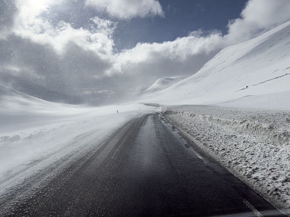
The United States is encountering severe winter travel disruptions throughout California’s Sierra Nevada range as a powerful Pacific storm system delivers heavy snowfall, gale-force winds, and hazardous driving conditions. Running from November 13 to November 14, 2026, the severe weather prompted the National Weather Service (NWS) to issue Winter Storm Warnings across the Greater Lake Tahoe area, Mono County, and surrounding high-altitude zones. Rapidly accumulating snow and severely reduced visibility are creating dangerous transit conditions. State transportation officials have already confirmed multiple snow-related closures across major mountain transit corridors, including portions of State Routes 4, 108, and 120. These severe atmospheric conditions are complicating travel itineraries for tourists heading toward Lake Tahoe, Mammoth Lakes, Yosemite National Park, and other prominent mountain retreats, with the possibility of extended precipitation lingering into the following week.
Severe Pacific Storm Triggers Major Transit Hazards Across California Mountains
Meteorological authorities report that a robust Pacific moisture plume is sweeping across northern and central California, bringing intense precipitation and turbulent winds, with the most severe weather concentrated at elevated terrains. The Greater Lake Tahoe district is under an active Winter Storm Warning, taking effect from mid-morning on November 13 and extending through the morning of November 14. Meteorological projections highlight that heavy snowfall will intensify significantly through Friday afternoon and evening before beginning to taper off by Saturday morning. Exposed mountain passes face near-whiteout conditions, drastically compromising visibility for motorists navigating the Sierra Nevada.
Lake Tahoe Braces for Up to Twenty Inches of Snow and High-Velocity Winds
Forecasters anticipate roughly 12 inches of snow accumulation above the 7,000-foot elevation mark in the Greater Lake Tahoe vicinity, with totals reaching up to 20 inches along the high Sierra crest directly west of the lake. Elevations sitting below 7,000 feet could record up to six inches of snow. Concurrently, ridge-line wind gusts are projected to range between 70 and 90 mph, while local communities such as Truckee and the immediate Tahoe basin could experience gusts spanning 45 to 55 mph. This combination of heavy, moisture-laden snowfall and intense wind activity elevates the danger of treacherous road conditions, snapping tree limbs, and potential power outages.
Friday Evening Commute Faces Peak Snowfall Intensity Near Lake Tahoe
According to meteorological data from the Reno National Weather Service office, the heaviest snow accumulation around Lake Tahoe is anticipated during the late afternoon and evening hours of November 13. Snowfall rates are projected to hit one to two inches per hour, with localized bursts nearing three inches per hour along the crest. Such rapid accumulation rates quickly obscure road surfaces, degrade driver visibility, and challenge snow-removal operations on mountain highways. This peak intensity coincides directly with the Friday evening travel window, when weekend visitors, local commuters, and commercial haulers navigate toward high-altitude settlements.
California Transportation Authorities Confirm Highway Closures Across Mountain Passes
The California Department of Transportation (Caltrans) has implemented active closures across several high-elevation transit corridors. State Route 120 remains closed between Crane Flat and the area west of its intersection with US Highway 395 near Tioga Pass due to hazardous snow depths. Additionally, State Route 108 is closed over Sonora Pass, and an upper section of State Route 4 near Ebbetts Pass is restricted for the same reason. Caltrans urges drivers to utilize alternative routes where available. Because mountain pass accessibility fluctuates rapidly under dynamic weather patterns, motorists are advised to check real-time road conditions prior to embarking on any trip.
Eastern Sierra Nevada and Mammoth Lakes Experience Heavy Accumulations
The incoming storm is also heavily impacting the eastern Sierra Nevada corridor, encompassing Mammoth Lakes and surrounding regions within Mono County. Forecasters highlight the period from Friday afternoon through late evening as the most critical window for heavy snowfall, with conditions projected to improve gradually by Saturday. Caltrans has enforced mandatory chain and snow-tire regulations across designated segments of State Route 203 and State Route 158. Furthermore, the upper stretch of State Route 203 past the Mammoth Mountain Inn toward the Mono-Madera county line is closed for the winter season. Travelers heading to regional lodgings or recreational zones should differentiate between standard seasonal closures and temporary weather-induced restrictions.
Extended Winter Storm Warnings Issued for Yosemite and Southern Sierra Regions
The National Weather Service office in Hanford has established a separate Winter Storm Warning for high-elevation zones sitting above 6,000 feet, remaining in effect through the morning of Tuesday, November 17. This extended advisory covers mountainous terrain associated with Yosemite, Kings Canyon, and Sequoia national parks. Projected snowfall totals in these southern sectors could approach 20 inches, accompanied by wind gusts reaching up to 50 mph. Forecasters caution that transit may become severely impaired or completely impassable during periods of peak snowfall, with elevated risks across bridges and overpasses.
Winter Weather Disrupts Lake Tahoe Tourism and Outdoor Recreational Access
While the scenic Sierra landscape draws countless visitors for seasonal tourism and outdoor recreation, severe storms present immediate operational and safety challenges. Heavy snow accumulations can obstruct pathways to lodgings, trailheads, and recreational facilities. Furthermore, wind warnings highlight wave heights of two to five feet on Lake Tahoe, creating hazardous conditions for small watercraft. Individuals planning lakeside trips or alpine activities should review weather advisories carefully, though standard warnings do not inherently mean all commercial ski resorts or lodging providers have ceased operations.
Travelers Encounter Potential Itinerary Disruptions and Route Diversions
The most pronounced effect on regional tourism involves transit reliability and highway access. Tourists driving from urban centers such as Sacramento, Reno, or adjacent lowlands toward the Sierra Nevada may encounter shifting road conditions as the weather system evolves. Heavy snow loads, strong crosswinds, and reduced visibility can significantly lengthen travel times and render certain routes unsuitable for standard vehicles. Visitors with pre-arranged lodging or activity reservations should verify operational access directly with their providers. While official advisories signal potential chain controls and closures, specific restrictions must be confirmed through official transit portals rather than general forecasts.
Drivers Advised to Pack Emergency Supplies and Obey Roadway Restrictions
Transportation and weather agencies strongly advise motorists who must travel through storm-affected areas to equip their vehicles with emergency supplies, including non-perishable food, water, and lighting tools. Drivers should also pack appropriate cold-weather apparel and verify that their vehicles satisfy all active tire and chain mandates. Consulting live highway databases prior to departure and strictly obeying instructions at chain-control checkpoints is essential. Motorists must never attempt to bypass physical road barriers or drive on closed routes. For non-essential trips, postponing travel until weather conditions stabilize remains the safest course of action.
Subsequent Weather Systems Threaten Extended Mountain Transit Delays
Even though the primary snowfall associated with the initial storm front is anticipated to subside by Saturday morning in the Tahoe basin, forecasters are monitoring a subsequent, colder weather system projected to impact the region from Sunday evening through Tuesday. This incoming disturbance could introduce fresh mountain snowfall alongside rain at lower elevations. Consequently, a temporary reprieve in weather on Saturday does not ensure clear travel conditions for the remainder of the week. Anyone organizing extended trips, multi-day vacations, or departures across high mountain passes should maintain vigilance by monitoring ongoing meteorological updates.
Flexible Itineraries Essential for Navigating Sierra Nevada Winter Storms
This November weather event serves as a clear illustration of how rapidly shifting mountain conditions can impact regional transport and tourism across the western United States. Official warnings document significant snowfall, gale-force winds, and challenging transit environments, complemented by confirmed highway restrictions implemented by Caltrans. The most critical travel impacts remain concentrated in high-elevation zones surrounding Lake Tahoe, Mammoth Lakes, and the southern Sierra national parks. By staying informed through official National Weather Service updates, verifying real-time highway statuses, and adapting travel plans accordingly, visitors can successfully navigate the complexities of winter mountain transit.